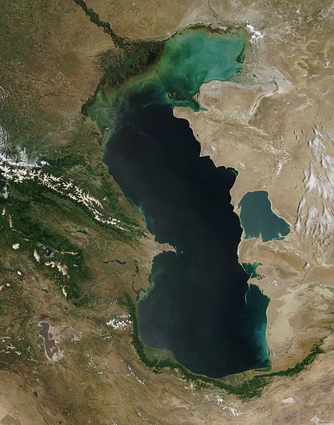
Fichier:Caspian Sea from orbit.jpg

Taille de cet aperçu : 471 × 599 pixels. Autres résolutions : 188 × 240 pixels | 377 × 480 pixels | 603 × 768 pixels | 804 × 1 024 pixels | 1 609 × 2 048 pixels | 4 400 × 5 600 pixels.
Fichier d’origine (4 400 × 5 600 pixels, taille du fichier : 3,44 Mio, type MIME : image/jpeg)
Historique du fichier
Cliquer sur une date et heure pour voir le fichier tel qu'il était à ce moment-là.
| Date et heure | Vignette | Dimensions | Utilisateur | Commentaire | |
|---|---|---|---|---|---|
| actuel | 14 juin 2010 à 10:16 |  | 4 400 × 5 600 (3,44 Mio) | Originalwana | higher res |
| 8 février 2005 à 16:10 |  | 550 × 700 (67 kio) | Pixeltoo | Caspian sea by space Nasa |
Utilisation du fichier
Aucune page n’utilise ce fichier.
Usage global du fichier
Les autres wikis suivants utilisent ce fichier :
- Utilisation sur af.wikipedia.org
- Utilisation sur als.wikipedia.org
- Utilisation sur am.wikipedia.org
- Utilisation sur ang.wikipedia.org
- Utilisation sur an.wikipedia.org
- Utilisation sur arc.wikipedia.org
- Utilisation sur ar.wikipedia.org
- بحر قزوين
- ويكيبيديا:صور مختارة/الفضاء والكون/نظرة إلى الخلف
- ويكيبيديا:ترشيحات الصور المختارة/بحر قزوين
- ويكيبيديا:صورة اليوم المختارة/ديسمبر 2016
- قالب:صورة اليوم المختارة/2016-12-23
- مستخدم:قائمة أكبر البحيرات والبحار في المجموعة الشمسية
- ويكيبيديا:صورة اليوم المختارة/يوليو 2020
- قالب:صورة اليوم المختارة/2020-07-16
- ويكيبيديا:صورة اليوم المختارة/يوليو 2023
- قالب:صورة اليوم المختارة/2023-07-26
- Utilisation sur arz.wikipedia.org
- Utilisation sur ast.wikipedia.org
- Utilisation sur as.wikipedia.org
- Utilisation sur av.wikipedia.org
- Utilisation sur azb.wikipedia.org
- Utilisation sur az.wikipedia.org
- Utilisation sur bat-smg.wikipedia.org
- Utilisation sur be.wikipedia.org
- Utilisation sur bew.wikipedia.org
- Utilisation sur bg.wikipedia.org
- Utilisation sur bh.wikipedia.org
- Utilisation sur bn.wikipedia.org
- Utilisation sur br.wikipedia.org
- Utilisation sur bs.wikipedia.org
- Utilisation sur bxr.wikipedia.org
- Utilisation sur ca.wikipedia.org
- Utilisation sur ce.wikipedia.org
- Utilisation sur ckb.wikipedia.org
- Utilisation sur co.wikipedia.org
- Utilisation sur cs.wikipedia.org
Voir davantage sur l’utilisation globale de ce fichier.


